Administrative Divisions of the Achaemenid Empire, 490 BC via Ian Mladjov’s Maps.Greek colonies in the northern Black Sea via Wikimedia
Darius’ wars with the Liar Kings with identifiable locations markedScythian Campaign of 515 BCE via Wikimedia
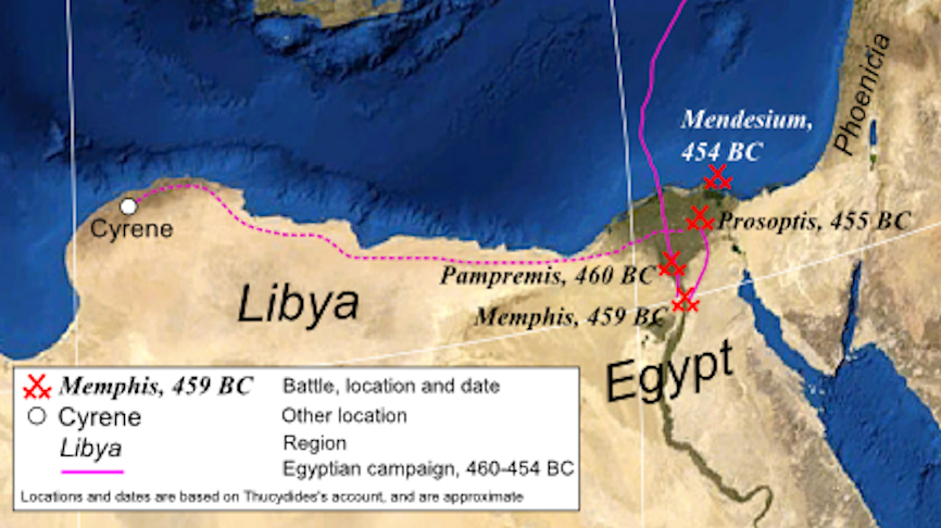
Ancient Egypt and Kush during Cambyses II’s invasion, with the locations of named locations and battles marked. Base map via Wikimedia.
The Eastern Mediterranean Sea at the time of Cambyses II’s invasion of Egypt
The Persian Empire up to 500 BCE. Note the key on the bottom left for the different phases of expansion under Cyrus, Cambyses, and Darius. Labels using the Old Persian names with the Greek names in parentheses via Ian Mladjov’s Maps.
The Neo-Babylonian Empire at the time of Cyrus’s Conquest with the locations of major battles. Base map via Wikimedia.
The Ancient Aegean via Wikimedia. Labels by Trevor Culley
Map of Iron Age West Asia via Wikimedia. Additions by Trevor Culley
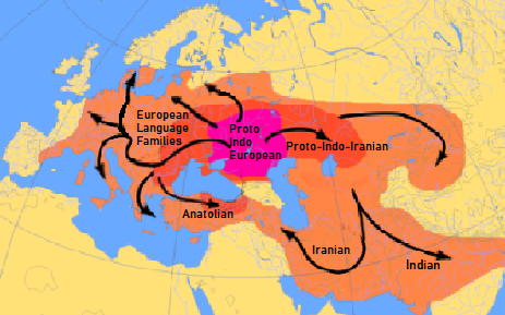
Map of Indo-European Migrations. Pink represents the original range. The darker areas represent earlier migrations. The lighter areas represent later migrations via Wikimedia. Additions by Trevor Culley
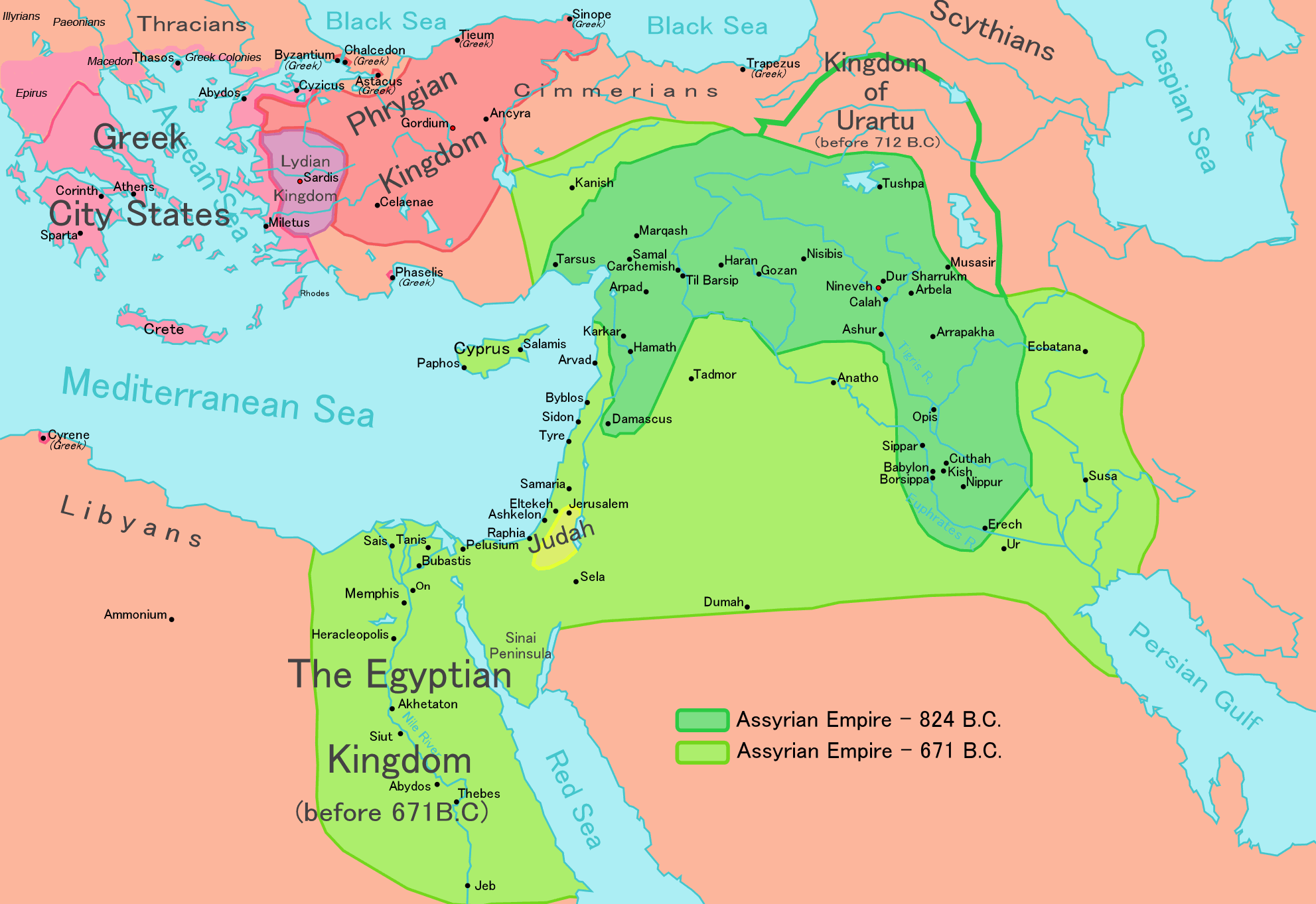
Neo-Assyrian Empire after its periods of greatest expansion via Wikimedia
My homemade map of the Near East between the Bronze Age Collapse and the Neo-Assyrian EmpireWest Asia and the Eastern Mediterranean c. 1800 BCE via Wikimedia
Map of the Near East before the Bronze Age Collapse via Wikimedia.


.svg)